Mes: mayo 2025 (Página 6 de 23)

Amplio operativo de búsqueda de una «persona que cayó al mar» a 1,5 millas de Foz con helicóptero y salvamento.

«Persona al agua a 1,5 millas al norte de Foz, se ruega a los buques extremen la vigilancia y den aviso a Salvamento Marítimo», advertían a la Guardia Civil; todo se inició por un chaleco salvavidas hallado en el agua

Este sábado por la mañana llamó la atención en la zona del litoral de Foz un amplio operativo de búsqueda con el helicóptero y lancha de salvamento. A pesar de las llamadas a diferentes controles de vigilancia, nadie acertaba a explicar qué estaba sucediendo. El helicóptero y la embarcación de Salvamento vigilaban por toda la zona litoral focense, en especial por las inmediaciones de Peizás.

Posteriormente desde la embarcación de la Guardia Civil se daba o recibía aviso, «persona al agua, aviso, persona al agua a 1,5 millas al norte de Foz; se ruega a los buques que anden por la zona que extremen la vigilancia y contacten de ser necesario con Salvamento Marítimo ante cualquier novedad». Según apuntan diversas fuentes, todo el operativo se inició ante la alerta dada tras hallar un chaleco salvavidas en el mar. Pudo tratarse de una falsa alarma.

La vigilancia continúa, no obstante, por todo el litoral. Hay aviso a las embarcaciones para que adviertan a Salvamento Marítimo cualquier incidencia o novedad y a los barcos y embarcaciones para que revisen sus equipos.

Fuente:lavozdegalicia.es

Exploran el océano Pacífico y encuentran un submarino perdido desde la I GM

El submarino se hundió en 1917. La tecnología de sonar multihaz y las cámaras de alta resolución han permitido encontrarlo y ‘reconstruirlo’ en tres dimensiones.

Una imagen del robot recorriendo la cubierta del submarino (Woods Hole Oceanographic Institution.

El hallazgo del submarino USS F-1, desaparecido hace más de un siglo, ha sido posible gracias a una expedición liderada por la Woods Hole Oceanographic Institution, que ha empleado tecnología de vanguardia para explorar los restos localizados frente a las costas de California.

Durante una operación técnica entre febrero y marzo, los equipos científicos descendieron hasta los 400 metros de profundidad para documentar por primera vez el naufragio. La misión, concebida inicialmente como un ejercicio de entrenamiento, permitió generar imágenes inéditas del pecio, utilizando los vehículos especializados Alvin y Sentry, ambos pertenecientes a la flota del National Deep Submergence Facility.

Una de las pocas imágenes que se conservan del USS F-1.

El trabajo fue financiado por la Fundación Nacional de Ciencia y contó con el respaldo de la Oficina de Investigación Naval y otras entidades oceanográficas. Los sistemas de sonar multihaz, cámaras de alta resolución y técnicas de fotogrametría permitieron crear modelos tridimensionales del submarino, cuyo casco se encuentra sorprendentemente intacto tras más de 100 años bajo el mar.

Además del valor arqueológico, la expedición rindió tributo a los 19 marineros que perdieron la vida el 17 de diciembre de 1917. Sobre el punto del naufragio, se celebró una ceremonia a bordo del buque Atlantis, en la que se leyeron sus nombres y se hicieron sonar 19 campanadas como recuerdo simbólico.

Innovación al servicio de la historia

El arqueólogo subacuático Brad Krueger, perteneciente al Naval History and Heritage Command, realizó su primera inmersión en un pecio histórico. “Fue una experiencia emocionante y profundamente respetuosa”, declaró tras el descenso en el sumergible Alvin, donde pudo observar de cerca la estructura del submarino.

Las imágenes obtenidas por los vehículos de la misión permitieron detectar no solo el estado estructural del F-1, sino también documentar los organismos que lo han colonizado. Esta información es crucial para entender la evolución de los ecosistemas sobre pecios históricos en aguas profundas.

Reconstrucción 3D del USS F-1.

“Aunque los 400 metros de profundidad no suponen un desafío extremo para nuestros equipos, cada inmersión requería preparación meticulosa y un enfoque prudente”, explicó Anna Michel, jefa científica de la expedición. Los resultados, según añadió, se compartirán con la comunidad científica internacional como parte del archivo histórico del National Deep Submergence Facility.

elconfidencial.com

España pierde un submarino y la Armada arranca una «angustiosa carrera contrarreloj» para encontrarlo

El Submarino S-81 de la Armada ‘isaac Peral’ atraca en Marín (Pontevedra, España).

Un nuevo ejercicio del ejército español ha puesto al límite a los soldados de la Marina. El supuesto: la desaparición de un submarino español S-8. Con la incertidumbre sobre el paradero de la tripulación, el ejército comenzó una angustiosa carrera contrarreloj, movilizando medios navales, aéreos y terrestres. Finalmente, el buque fue localizado en el fondo del mar. 

Según publica el medio El Debate, el submarino en cuestión es uno de los más avanzados de la Armada Española, y, por tanto, existe un rígido protocolo que hay que seguir obligatoriamente. «Si el buque se queda en el fondo del mar, dispone de determinados sistemas de SOS para ayudar a su localización». Para los tripulantes, «hay una zona intermedia llamada cofferdam, con elementos de rescate y salvamento como comida, agua y unos trajes especiales para intentar salir llegado el momento».

De acuerdo a la información difundida, el incidente «activa todas las alarmas: búsqueda subacuática, movilización de unidades aéreas y navales, asistencia médica, atención psicológica a las familias y gestión de la presión mediática». Sin embargo, el mayor enemigo es el tiempo.

Esta actividad forma parte del Cartago 25, un ejercicio de comunicación de crisis y rescate submarino organizado por la Armada Española y la Universidad Católica de Murcia. «Se busca preparar a profesionales civiles y militares ante el peor de los escenarios posibles: la pérdida de un submarino y la angustia colectiva que desencadenaría». 

Un comunicado del Ministerio de Defensa y recogido por el medio, subraya cómo el papel de la logística y la coordinación de los medios aéreos, navales, militares y civiles, es esencial en este tipo de operaciones de rescate tan complejas, «donde el tiempo juega a la contra». 

«Para que sus dotaciones mantengan un alto nivel de adiestramiento se realiza anualmente este ejercicio de rescate de un supuesto submarino de la moderna serie S-80″, concluye la publicación. Además, cada vez tienen más presencia los drones y medios de alta tecnología.

👍»Memoria histórica»

Isabel Durantez

«Cachondeo Nacional»

Nada ha cambiado y los políticos encantados.

Legislar…legislan…

Grupo de Expertos no Gubernamentales del Sistema Mundial de Socorro.

Exigimos el cese del Director General de la Marina Mercante.

Su inacción y autocomplacencia ante los intereses políticos de los que lo seleccionaron como «persona idónea» como director general y presidente de Sasemar, le hace responsable directo del episodio contaminante – accidental-
de productos nocivos contemplados en el Sistema Nacional de Respuesta.

Desde que Sasemar tuvo constancia del episodio contaminante, debió activarse la fase de emergencia 3, para vigilar, contener, combatir y reducir la contaminación por pellets, activando las unidades de intervención inmediata (Task Force) con base en Fene/Ferrol.

Nota de Prensa

Pellets

Este Grupo, quiere dejar constancia ante la opinión pública que «todo está planificado» para combatir posibles episodios contaminantes.

A la vez que ADVIERTE

JUSTIFICACION

5 de octubre de 2010

El BOE publicaba la aprobación del Sistema Nacional de Respuesta y el Plan Marítimo Nacional respecto al Salvamento Marítimo y Lucha Contra la Contaminación.

Lo firmaba la entonces Directora General de la Marina Mercante Isabel Durantez.

La Dirección General de la Marina Mercante tendrá la responsabilidad en caso de emergencia

Las emergencias en el mar tendrán desde hoy un marco normativo más claro.

El Consejo de Ministros da luz verde a un nuevo decreto que actualiza el de 2004 y lo adapta en plazo a la normativa europea de 2009, que fijaba como fecha tope para la trasposición el día 30 de noviembre.

No quedará tampoco desde hoy duda ninguna de quien es la máxima autoridad en un caso de emergencia en el mar.

«Concreta la autoridad competente en la persona que ostente la Dirección General de la Marina Mercante», añadió.

Este aspecto, que es uno de los que más expectación suscitaba en el nuevo decreto, pone fin a las lagunas del texto normativo de 2004 que atribuía la responsabilidad a la administración o autoridad marítima, que podía ir desde el jefe de distrito al ministro.

Una serie de aspectos marcarán la pauta para que desde la Dirección General de la Marina Mercante, su máxima responsable pueda tomar las decisiones con criterios «técnicos y objetivos».

El oleaje y el viento, junto con aspectos sociales, ambientales o económicos estarán claramente reflejados para que quede «garantizada su independencia».

La Coruña 11 de enero de 2024

Fdo

Antón Salgado/Luis Milian

La Coruña

Chief Engineers.

Restaurante «Comarea».

Ayer tuvo lugar en La Coruña, un almuerzo de 12 colegas Jefes de Maquinas de M.M.

Salieron alumnos de máquinas en 1964, hace ahora 60 años.

Según los asistentes, ha sido una experiencia maravillosa.

Como homenaje a toda la promoción, colocaron en el local un libro cuya portada era la orla de 1964.

Con diseño de Urbano Lugrís.

Recordatorio

«Lodos y tempestades»
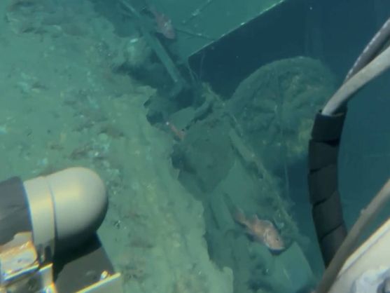
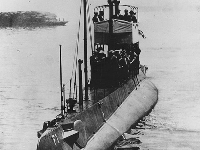
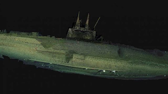
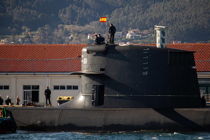
Prestige

Presentación del libro de López Sors en La Coruña

Grupo de Expertos no Gubernamentales del Sistema Mundial de Socorro

NOTA DE PRENSA

Miembros de este Grupo, presentes en el acto, quieren dejar constancia de su malestar por las manifestaciones públicas de López Sors, a la vez que rechazan el presunto contenido científico del Libro, tal como se manifestó en su presentación.

Justificación

El intrusismo profesional en la Dirección General de la Marina Mercante y Sasemar, la impericia náutica, del que dijo responsabilizarse del dictamen de la cadena de mando, ha sido y es evidente.

Los partidos políticos tienen por costumbre, cuando llegan al poder, de » colocar » a personas o personajes fieles a sus postulados y los premian con cargos de responsabilidad para los cuales, como en el caso del Prestige, se requiere una titulación además de cualificación y experiencia por normativa internacional.

Ahí es donde subyace toda la problemática del Prestige, en el intrusismo profesional, en el ordeno y mando a titulados náuticos que ocupaban sus cargos, no por su valía, sino por su fidelidad al poder establecido, debiendo y teniendo que decir » amén » a una orden de alejamiento del petrolero siniestrado contra natura.

La Organización Marítima Internacional y el Convenio Internacional de Titulación, Formación y Guardias para Gente de Mar ( STCW 75/98 ) son absolutamente esclarecedores para demostrar que el Ministerio de Fomento conculcaba la normativa internacional al tener al frente de la Dirección General de la Marina Mercante a un profesional carente del perfil exigido en la legislación vigente.

¿ Puede un Ingeniero Naval, Magistrada, Perito Agrícola o Abogado estar al frente de la Dirección General de la Marina Mercante o de Sasemary tomar o asumir decisiones para las que se requieren titulaciones y certificaciones que acrediten su pericia caso de siniestro o episodio contaminante ?

Esa es la pregunta todavía sin contestar y mucho menos resolver.

La actual diversificación de los cargos » por fachadas » , el intrusismo profesional vigente en cargos de responsabilidad y la manipulación política continuan campando a sus anchas con el consiguiente derroche de dinero público que para nada ha servido ni mucho menos servirá en el momento de la toma de decisiones.

La Organización Marítima Internacional define los planes de salvamento y contingencias como » un conjunto de comunicaciones y medidas para conseguir una respuesta eficaz «.

En la Catástrofe del Prestige las comunicaciones del Capitán Mangouras fueron eficaces porque llegaron a tierra en tiempo y forma pero las medidas fueron tardías, ineficaces y contra natura debido a la mala praxis de todos y cada uno de los intervinientes.

El domingo 14 de agosto de 2011, aparecían publicadas en un medio de comunicación escrita unas declaraciones del que fuera Delegado del Gobierno, Arsenio Fernandez de Mesa.

De forma definitiva, se demuestra la monumental estafa que sufrió Fernandez de Mesa por parte de la Dirección General de la Marina Mercante.

Efectivamente, el Delegado del Gobierno, estaba única y exclusivamente para coordinar a las administraciones central y autonómica en la gestión de la catástrofe.

Pero, cuidado, asumiento siempre las instrucciones emanadas desde la Dirección Ejecutiva de Operaciones en la Mar que tendría que estar dirigiendo las operaciones desde Madrid e informando por obligado cumplimiento al Director de la Emergencia que no era otro que el Director General de la Marina Mercante.

¿ Quién ostentaba el cargo de Director Ejecutivo de Operaciones en la Mar en aquellos momentos ?

El Subdirector General de Seguridad, Tráfico y Lucha Contra la Contaminación, que por cierto, tenía y tiene nombre y apellidos.

El ex Delegado del Gobierno sostiene que se ejecutaron los mismos protocolos que aplicó Pérez Touriño como Secretario General de Transporte Marítimo diez años antes, sin especificar en qué accidente o siniestro marítimo, lo cual ratifica que Fernandez de Mesa desconocía que estaba en pleno vigor el Plan Nacional de Contingencias desde febrero de 2001 y lógicamente debería estar perfectamente planificado y desarrollado el Plan Territorial de Contingencias de Galicia.

Todo ello significa que con errores o aciertos al crearse en la Delegación del Gobierno de La Coruña un Gabinete de Crisis, las responsabilidades siempre fueron políticas y no técnicas.

Un Gabinete de Crisis gestiona la protección civil mientras que un Plan Nacional de Contingencias ejecuta las decisiones de un Cuadro Orgánico eminentemente técnico marítimo que informa a las autoridades civiles que deberán acatar todas y cada una de las instrucciones de los mandos de la marina mercante tal y como se contempla en el Manual OPRC 90 de la OMI y sus actuales enmiendas.

El Plan Nacional de Contingencias contempla la formación a través de ejercicios programados de todos y cada uno de los intervinientes.

¿ Estaba formado o al menos informado el Delegado del Gobierno ?

¿ Quién o qué departamento de la Dirección General de la Marina Mercante era el responsable de facilitarle el Plan al Delegado del Gobierno ?

La misma pregunta en lo que respecta a la Xunta de Galicia que un tiempo después de la catástrofe reconocía no tener en vigor su Plan Territorial.

Entonces, los responsables de la catástrofe ¿ son los políticos o los funcionarios de alto nivel de la Dirección General de la Marina Mercante que no cumplieron con sus obligaciones ?

No olvidemos que el Plan Nacional de Contingencias nace en febrero de 2001 y la catástrofe del Prestige ocurrió a finales de 2003, es decir, el espacio de tiempo fue suficiente para formar/informar al Cuadro Orgánico que pudo haber participado con pleno acierto en el episodio contaminante.

Dicho todo esto, también queremos dejar bien claro, que si en lugar del Prestige hubiera sido un moderno petrolero, la gestión hubiera sido igual de lamentable.

En La Coruña a 24 de mayo 2025

Fdo

Antón Salgado/Luis Milian

Coordinadores

https://www.facebook.com/share/v/1Ad8gQefBj/

Summary of significant outcomes
Below is a brief overview of some of the significant outcomes from NCSR 12:
NCSR finalised the draft amendments to SOLAS chapter V and related instruments to support the introduction
of the VHF Data Exchange System (VDES) on voluntary basis. These include performance standards,
operational guidelines, and provisions allowing VDES to replace AIS. The draft documents will be submitted to
MSC 110 for approval and are expected to be adopted at MSC 111 in May 2026, with entry into force on 1
January 2028.
NCSR finalised draft guidelines on the carriage and use of an Electronic Nautical Publications (ENPs) system
on board to support uniform implementation of SOLAS regulations V/19.2.1.4,V/19.2.1.5 and V/27. The
guidelines will be submitted to MSC 111 for approval in May 2026, and should be effective immediately once
approved.
NCSR finalised the draft MSC circular on guidelines for software maintenance of shipboard navigation and
communication systems, focusing on cybersecurity, remote servicing, and standardised maintenance
processes. The draft guidelines are expected to be submitted for approval at MSC 111 (expected May 2026)
and should be effective immediately once approved.
NCSR continued work on the draft NAVDAT manual and roadmap for implementing the digital navigational
data system, building on resolutions adopted at MSC 109. Due to time constraints, finalisation was deferred
to NCSR 13 (expected June 2026), with approval expected at MSC 112 (expected December 2026).

Lloyd’s Register Briefing Note – Summary Report NCSR 12 Page 3
May 2025 ©Lloyd’s Register 2025
Introduction
NCSR 12 took place 13 – 22 May 2025 at the IMO in London. This report provides a summary of the outcomes
from the meeting which are significant to Lloyd’s Register’s (LR) work with our customers.
Lloyd’s Register contributed in the Working Group on Navigation.
Additional Information LR’s Summary Report for MSC 109 and Summary Report for NCSR 11
Navigation
Routeing measures and ship reporting systems
The safety of shipping and the cleanliness of oceans are enhanced by routing measures and ship reporting
systems. Ship reporting systems further improve safety by providing real-time information on ship
movements. SOLAS Chapter V designates the IMO as the sole international authority for establishing these
systems, ensuring safe and efficient maritime navigation.
NCSR agreed on the following:

  • A draft MSC resolution on amendments to an existing mandatory ship reporting system in the Adriatic
    Sea (ADRIREP)
  • A draft SN circular on area to be avoided off the coast of Reunion, in the Mascarene Basin.
  • Draft amendments to Resolution MSC.314(88) as a new annex for In the Sound Between Denmark and
    Sweden (SOUNDREP) and draft amendments to MSC.332 (90) in the existing annex for In the Storebælt
    (Great Belt) Traffic Area (BELREP) ship reporting systems.
    The finalised drafts are expected to be adopted at MSC 111 in May 2026, with implementation expected six
    months later.
    Information was submitted regarding the change of Chart Datum and value of minimum depth of 17.60 m in
    the deep-water route within the South Åland Sea traffic separation scheme. A proposal to issue an addendum
    3 to SN.1/Circ.272 was approved by NCSR.
    Development of procedures and requirements for the recognition of
    augmentation systems in the Worldwide Radionavigation System
    Global Navigation Satellite Systems (GNSS) are the primary source of Positioning, Navigation and Timing
    (PNT) information for ships worldwide. While adequate for ocean navigation, standalone GNSS systems often
    lack the accuracy and integrity needed for navigation in coastal waters and harbour approaches. To address
    this, augmentation systems such as Radiobeacon Differential GNSS (DGNSS), SBAS (Satellite Based
    Augmentation System) and RAIM (Receiver Autonomous Integrity Monitoring) are widely used to enhance
    GNSS performance.

IMO has previously recognised GNSS and Regional Navigation Satellite Systems (RNSS) constellations as part
of the Worldwide Radionavigation System (WWRNS) and adopted related performance standards. However,
formal procedures and requirements for recognising augmentation systems within WWRNS are still lacking. In
response, MSC approved outputs to develop such procedures before addressing performance standards for
dual frequency multi-constellation satellite-based augmentation systems (DFMC SBAS) and advanced receiver
autonomous integrity monitoring (ARAIM) in shipborne radionavigation receivers.
NCSR agreed on below:

  • Recognition of augmentation systems is not necessary as they are considered to be a method of
    improving GNSS attributes, such as accuracy, integrity, continuity and availability, not forming part of
    the WWRNS.
  • Draft MSC resolution on Amendments to WWRNS (resolution A.1046(27)) to incorporate additions to
    current procedures and requirements to include augmentation systems.
  • Initiating work on development of performance standards for DFMC SBAS and ARAIM in shipborne
    radionavigation receivers at NCSR 13 (June 2026).
    The draft MSC resolution is expected to be submitted for approval at MSC 111 in May 2026, with an anticipated
    entry into force on 1 January 2028.
    Development of amendments to SOLAS chapters IV and V and performance
    standards and guidelines to introduce VHF data exchange system (VDES)
    The Very High Frequency (VHF) Data Exchange System (VDES) integrates the functions of terrestrial and
    satellite VHF data exchange, Application Specific Message (ASM) and Automatic Identification System (AIS).
    VDES has additional capacity for the exchange of more digital data and could accommodate future growth in
    demand for using digital data in maritime radiocommunications. It was previously proposed at the IMO that
    there is a need to amend chapters IV and V of SOLAS to introduce VDES, and to develop performance
    standards and guidelines to facilitate the widespread adoption of VDES. Furthermore, MSC 108 agreed that
    the use of any new satellite system, including the VDES, for use in the GMDSS, should be recognised by the
    Organization in accordance with the applicable procedures.
    NCSR in its last session agreed on a voluntary implementation of the VDES as further developments take
    place, which will allow it to be used concurrently with an AIS.
    Progressing on, NCSR 12 finalised and agreed to the following:
  • Draft amendments to SOLAS chapter V, in particular inserting words «or VDES» after «AIS».
  • Consequential draft amendments to related mandatory instruments, such as the 1994 HSC Code and
    the 2000 HSC Code.
  • Consequential draft amendments to the records of equipment for the passenger ship safety (form P),
    cargo ship equipment (form E) and cargo ship safety (form C) Certificates.
    The draft instruments are expected to be submitted for approval at MSC 110 in June 2025 as an urgent matter
    and adopted at MSC 111 in May 2026, with an anticipated entry into force on 1 January 2028.
    Lloyd’s Register Briefing Note – Summary Report NCSR 12 Page 5
    May 2025 ©Lloyd’s Register 2025
    The following non-mandatory instruments are expected to be approved in principle at MSC 110 and formally
    adopted at MSC 111:
  • A draft MSC resolution on Introduction of VDES into the IMO regulatory framework;
  • A draft MSC resolution on performance standards for VDES; and
  • Draft guidelines for the operational use of shipborne VDES.
    Development of guidelines for the carriage and use of electronic nautical
    publications (ENP) System
    SOLAS regulations V/19.2.1.4, V/19.2.1.5 and V/27 require ships to have nautical charts and publications for
    voyage planning, display and monitoring, which can be in electronic form with appropriate backups.
    The use of ENPs in lieu of traditional nautical publications has surged in recent years due to their advantages.
    However, there is not an IMO instrument providing uniform instructions, though some guidance has been
    issued by national hydrographic offices. Therefore, urgent development of specific IMO-level guidance is
    considered necessary to ensure uniform and global implementation of the aforementioned SOLAS
    regulations.
    Acknowledging this, NCSR finalised and agreed to a draft MSC circular on Guidelines for the carriage and use of
    electronic nautical publications (ENP) system on board.
    The draft guidelines are intended for digital publications based on existing paper publications used on ships,
    rather than ENP displayed on Electronic Chart Display and Information Systems (ECDIS) and does not override
    any ECDIS performance standards requirements. It focuses on aspects such as hardware and software,
    adequate backup arrangements and power supply, rather than defining specific performance standards.
    The draft guidelines are expected to be submitted for approval at MSC 111 in May 2026 and should be effective
    immediately once approved.
    Communications
    Development of guidelines for software maintenance of shipboard navigation and
    communication equipment and systems
    As reliance on computer-based navigation and communication systems grows, effective software
    maintenance has become critical for maritime safety and operational efficiency. In response to industry
    challenges and evolving cyber risks, MSC 107 approved the development of non-mandatory guidelines,
    focusing on equipment regulated under SOLAS chapters IV (Radiocommunications) and V (Safety of
    Navigation).
    An initial industry standard, developed collaboratively by shipowners, service providers, classification
    societies, and equipment manufacturers, laid the foundation for these draft guidelines. Building on this, NCSR
    12 considered the draft guidance for software maintenance that promotes standardised, secure, and
    transparent processes. The guidelines aim to minimise downtime, enhance system reliability, improve crew
    awareness, and strengthen cybersecurity without increasing the frequency of maintenance tasks.
    Lloyd’s Register Briefing Note – Summary Report NCSR 12 Page 6
    May 2025 ©Lloyd’s Register 2025
    Key features of the draft guidelines include:
  • Clear roles and processes for initiating, planning, and executing maintenance,
  • Cybersecurity and safety measures throughout the maintenance lifecycle,
  • Use of electronic service reports and onboard software logs,
  • Training and certification of service personnel by equipment manufacturers,
  • Guidance for remote maintenance.
    NCSR agreed to the draft MSC circular on guidelines for software maintenance of shipboard computer-based
    navigation and communication equipment and systems. The draft guidelines are expected to be submitted for
    approval at MSC 111 in May 2026 and should be effective immediately once approved.
    Development of guidance to establish a framework for data distribution and
    global IP-based connectivity between shore-based facilities and ships for ECDIS S-
    100 products
    To support the transition to next-generation S-100 capable electronic chart display and information systems
    (ECDIS), MSC 109 recognised the need for a robust framework enabling secure and standardised IP-based data
    exchange between shore-based facilities and ships. This transition is essential for delivering real-time
    navigational, meteorological, and other S-100 products, enhancing maritime safety and situational
    awareness.
    NCSR 12 considered the draft guidance to establish a framework for data distribution and global IP-based
    connectivity for shore-based facilities and ships supporting ECDIS S-100 products. The draft guidance aims to
    address the technical, operational, and cybersecurity challenges associated with the transition to S-100
    ECDIS. It leverages existing digital technologies such as the Maritime Connectivity Platform (MCP) and the
    Secure communication between ship and shore (SECOM) Protocol to ensure:
  • Secure communication through encryption and authentication.
  • Service discovery within maritime digital networks.
  • Data interoperability across different systems.
  • Real-time data exchange for timely access to critical updates.
    The draft guidance also emphasises the importance of training shore-based staff and familiarising seafarers
    with the new systems. While designed for S-100 ECDIS, the framework can be extended to other maritime
    digital services, supporting the sector’s broader digital transformation.
    Due to time constraints, the review of the draft guidelines and the draft list of elements associated with the
    implementation of S-100 capable ECDIS could not be completed, and the work will continue during the
    intersessional period. Finalisation is expected at NCSR 13 next year, with approval anticipated at MSC 112. The
    guidelines should be effective immediately upon approval.
    Lloyd’s Register Briefing Note – Summary Report NCSR 12 Page 7
    May 2025 ©Lloyd’s Register 2025
    Search and Rescue
    Developments in GMDSS services, including guidelines on maritime safety
    information (MSI)
    Issues concerning the dissemination of maritime safety information (MSI) and search and rescue (SAR)
    MSC 108 discussed significant developments in Global Maritime Distress and Safety System (GMDSS) services,
    particularly focusing on the dissemination of Maritime Safety Information (MSI) and instructed NCSR to draft
    amendments to SOLAS, mandating the dissemination of MSI and SAR (Search and Rescue) related information
    through all operational RMSSs (Recognised Mobile Satellite Services). The implementation date for
    disseminating MSI through all operational RMSSs was set to be no later than 31 December 2026.
    In line with above, NCSR at its last session had Instructed the joint IMO/ITU Experts Group to draft SOLAS
    amendments. NCSR at this session finalised and agreed to below draft amendments to clearly state the
    requirement for dissemination of maritime safety information and SAR related information through all
    operational recognised mobile satellite services:
  • Draft amendment to SOLAS regulation IV/5 (provision of radiocommunication services), SOLAS
    regulations V/4 (navigation warnings) and SOLAS V/5 (meteorological services and warnings);
  • Draft amendment to Resolution MSC.509(105) on Provision of radio services for the Global Maritime
    Distress and Safety System.
    The draft instruments are expected to be submitted for approval at MSC 110 in June 2025 as an urgent matter
    and adopted at MSC 111 in May 2026, with an anticipated entry into force on 1 January 2028.
    Consideration of matters related to NAVDAT (A digital navigational data system) implementation
    At its last session NCSR approved the draft MSC resolution on Performance Standards for digital navigational
    data system (NAVDAT) and the draft revision of resolution MSC.509(105) on Provision of radio services for the
    Global Maritime Distress and Safety System (GMDSS), which later got adopted by MSC 109. It further Instructed
    the Joint IMO/ITU Experts Group to review the draft NAVDAT manual, consider the revised roadmap, and
    advise accordingly.
    Considering the work done by the Joint IMO/ITU Experts Group, NCSR 12 continued work on developing the
    draft NAVDAT manual. It also progressed on the road map on the issues to be considered regarding the
    introduction of the NAVDAT service.
    Due to time constraints, the review of the draft manual could not be completed and will continue during the
    intersessional period. Finalisation is expected at NCSR 13 next year, with approval anticipated at MSC 112 in
    December 2026. The guidelines should be effective immediately upon approval.
    Lloyd’s Register Briefing Note – Summary Report NCSR 12 Page 8
    May 2025 ©Lloyd’s Register 2025
    Development of global maritime SAR services, including harmonisation of
    maritime and aeronautical procedures and amendments to the IAMSAR Manual
    Search and rescue impacts of MASS
    MSC 109 considered the search and rescue implications for Maritime Autonomous Surface Ships (MASS),
    noting that Chapter 23 of the MASS Code remains under development. It decided that the invitation to NCSR
    to review the chapter will take place after the finalisation and adoption of the non-mandatory code –
    finalisation of the Code is expected at MSC 111 in May 2026.
    Additionally, following the work carried out by the ICAO/IMO Joint Working Group, NCSR noted the
    understanding that remotely piloted aircraft (RPA) and other autonomous craft are not required to conduct
    searches for craft with no persons on board, and that distress beacons should not be used for alerting on craft
    with no persons on board.
    Amendments to the IAMSAR Manual
    This is a standing agenda item which addresses amendments to the IAMSAR Manual. Shipowners, operators
    and Masters should note that the IAMSAR Manual is a surveyable item and ships are required to carry the most
    up to date edition. The current edition of the IAMSAR Manual was published on 1 June 2022. The next edition
    had been finalised at NCSR 11 last year and is due to be published in June 2025.
    NCSR at this session initiated the work on the preparation and discussion of proposed draft amendments to
    the IAMSAR Manual for its 2028 edition. The following matters for discussion and finalisation at future sessions
    of NCSR may be included in that edition:
  • Radar SART and the related draft amendments.
  • Psychology of emergency on the principle that SAR personnel could benefit from further detailed
    guidelines on psychological first aid, including the possibility of developing a draft circular on the
    subject.
  • Optimising homing operations for 406 MHz distress beacons and automatic identification system (AIS)
    signals.
  • Guidance on submarines and passenger submersible craft and related SAR issues.
    Additionally, NCSR also agreed to a revision of Procedure for responding to DSC distress alerts by ships
    (MSC.1/Circ.1657), comprising modifications to enhance consistency and alignment with the relevant
    provisions of Recommendation ITU-R M.541-11 (Operational procedures for the use of digital selective calling
    equipment in the maritime mobile service ) as well as of those in Recommendation ITU-R M.585-9 (Assignment
    and use of identities in the maritime mobile service). The draft revision is expected to be submitted to MSC 111
    for approval in May 2026, and should be effective immediately once approved.
    Subject to approval of the draft revisions to MSC.1/Circ.1657, consequential amendments to IAMSAR and
    GMDSS manuals would be necessary in due course.
    Guidance for entering and updating information on search and rescue services into the Global SAR Plan
    NCSR 11 last year identified the need to improve guidance on entering and updating maritime search and
    rescue (SAR) service information in the GISIS Global SAR Plan. The Secretariat was tasked with preparing
    consolidated guidance, incorporating existing materials and new criteria for defining Search and Rescue
    Regions (SRRs). This supports harmonisation of maritime and aeronautical SAR procedures and enhances
    global SAR coordination.
    Lloyd’s Register Briefing Note – Summary Report NCSR 12 Page 9
    May 2025 ©Lloyd’s Register 2025
    NCSR finalised and approved the draft COMSAR circular on Guidance for entering and updating information on
    search and rescue services into the Global SAR Plan and on how to get access to the information for
    operational use.
    Revision of the Performance Standards for Shipborne BeiDou Satellite Navigation
    System (BDS) Receiver Equipment (resolution MSC.379(93))
    The BeiDou Satellite Navigation System (BDS) was recognised by IMO in 2014 as part of the World-Wide
    Radionavigation System (WWRNS), with performance standards adopted under resolution MSC.379(93). Since
    its full commissioning in 2020, BDS has operated reliably and now offers enhanced services, including
    improved positioning accuracy, dual-frequency capabilities, and global PNT and messaging functions.
    In response to these advancements, a proposal was submitted to the NCSR to revise the performance
    standards. The draft revision enables the shipborne BDS receiver equipment to support or integrate new
    navigation signals and support the use of single-frequency and dual-frequency modes with enhanced
    positioning accuracy and sensitivity to promote the development of equipment in the maritime industry and
    enable maritime users to use the improved services provided by BDS.
    Following consideration of the proposed amendments, NCSR 12 reviewed and finalised the draft revision of
    MSC.379(93) Performance standards for shipborne BeiDou Satellite Navigation System (BDS) receiver equipment
    to align with the current BDS capabilities.
    The draft revision is expected to be submitted to MSC 111 (May 2026) for approval and should be applicable to
    the BDS receiver equipment installed on or after 31 July 2028.
    Lloyd’s Register Briefing Note – Summary Report NCSR 12 Page 10
    May 2025 ©Lloyd’s Register 2025
    Any other business
    Progress on standards development by IEC
    Technical Committee 80 of the International Electrotechnical Commission (IEC TC 80) is responsible for the
    preparation of standards for maritime navigation and communication equipment and systems.
    NCSR 12 noted the report from IEC TC 80 on the progress of standards completed and under development
    which will support performance standards and other IMO instruments. This is a standard report which
    included, but is not limited to the following):
    Area Standard Status
    GNSS IEC 61108-8: Maritime navigation and radiocommunication
    equipment and systems – Global navigation satellite systems
    (GNSS) – Part 8: Quasi-Zenith Satellite System (QZSS) receiver
    equipment – Performance requirements, methods of testing and
    required test results.
    Target
    publication: 2028
    ECDIS IEC 61174 (revision) Maritime navigation and
    radiocommunication equipment and systems – Electronic chart
    display and information system (ECDIS) – Operational and
    performance requirements, methods of testing and required test
    results
    In progress
    CMDS (Route
    Exchange)
    IEC 63173-1: Maritime navigation and radiocommunication
    equipment and systems – Data interfaces – Part 1: S-421 route
    plan based on S-100 and IEC 63173-2: Maritime navigation and
    radiocommunication equipment and systems – Data interfaces –
    Part 2: Secure communication between ship and shore (SECOM).
    In progress,
    alongside ECDIS
    standard
    VDES New standard in progress Ongoing with ITU
    & IALA
    GMDSS (VHF) IEC 61097-7 (revision) Global maritime distress and safety
    system (GMDSS) – Part 7: Shipborne VHF radiotelephone
    transmitter and receiver – Operational and performance
    requirements, methods of testing and required test results
    Target
    publication: 2026
    GMDSS (MF/HF) IEC 61097-9 (revision) Global maritime distress and safety
    system (GMDSS) – Part 9: Shipborne transmitters and receivers for
    use in the MF and HF bands suitable for telephony, digital
    selective calling (DSC) and reception of Maritime Safety
    Information and Search and Rescue related information –
    Operational and performance requirements, methods of testing
    and required test results
    Target
    publication: 2026
    VHF DSC (Non-
    SOLAS)
    IEC 62238 (revision) Maritime navigation and
    radiocommunication equipment and systems – VHF
    radiotelephone equipment incorporating Class «D» Digital
    Selective Calling (DSC) – Methods of testing and required test
    results
    This standard is of interest to ships for which the SOLAS
    Convention does not apply but that participate in the GMDSS.
    In progress

Un carguero encalla en el jardín de una casa en la costa noruega mientras su dueño dormía.

El único marinero que estaba en el puente de mando dijo que se había quedado dormido. «Cuando miré por la ventana, había una enorme proa allí», declaró el dueño de la vivienda.

Un carguero, de 135 metros de eslora, encalló por accidente en el jardín de una casa en la localidad de Byneset, en la costa oeste de Noruega, informaron medios de este país nórdico.

El accidente se registró en la madrugada del jueves mientras Johan Helberg, el dueño de la vivienda, dormía, tal y como recoge Efe.

«Fue completamente absurdo. Cuando miré por la ventana, había una enorme proa allí», dijo Helberg a la televisión pública NRK.

Helberg no escuchó el ruido del barco al encallar y fue su vecino quien lo despertó después de llamar a la puerta varias veces.

«Si hubiera encallado cinco metros a la izquierda, se habría deslizado hacia arriba por las rocas y mi casa habría quedado de forma muy distinta», dijo Helberg.

La Policía noruega ha informado de que solo había una persona en el puente de mando a cargo de la navegación, y aunque todavía no hay causa oficial del accidente, se ha descartado que fuera un fallo técnico o que el individuo se encontrara bajo los efectos del alcohol.

Según NRK, el tripulante declaró durante el interrogatorio que se había quedado dormido.

El barco se dirigía desde el norte de Noruega a la localidad de Orkanger, situada dentro del fiordo de Trondheim.

Fuente:lavozdegalicia.es

MAS DE LO MISMO: RESPUESTAS INCONGRUENTES

(2007)

1 8 9 2 9 3
SECRETARIA DE ESTADO DE RELACIONES CON LAS CORTES
j.p./1.1.

RESPUESTA DEL GOBIERNO
(184) PREGUNTA ESCRTTA CONGRESO

18410116235/0000
23/03/07 01822t9

AUTOR/A : RODRÍGUEZ SÁNCHEZ, Francisco (GMX)

RESPUESTA:

Los Centros de Coordinación de Salvamento Marítimo pertenecientes a la Sociedad de Salvamento y Seguridad Marítima, han sido dotados de los equipos más adecuados y modernos del Sistema de Identificación de Buques durante los últimos meses, dando cumplimiento al Real Decreto 21O/2004 que tiene como finalidad completar la incorporación al ordenamiento jurídico español de la Directiva 2002/59/CE y en cuya disposición transitoria única indica que el proceso de establecimiento de estos equipos habrá de culminarse no más tarde del 31 de diciembre de 2007 y deberá de estar en condiciones para transmitir la información e intercambiarla con los sistemas de los restantes Estados miembros de la Unión Europea un año después.

El Sistema Automático de Identificación de Buques (AIS/SIA) al igual que otras ayudas a la navegación o sistemas de radio comunicaciones, forman parte del programa de materias que conforman los estudios de marina civil en general.

Concretamente, tal materia figura como tema no 7 de la Diplomatura en Navegación Marítima de la Facultad de Náutica de Barcelona bajo el epígrafe:

Nuevo escenario de la radiocomunicaciones marítimas: lnternet, AIS o Exigencias logísticas y tecnológicas del Sistema AIS en el ámbito de las comunicaciones.

Además, la Administración Marítima, considerando la importancia que tiene el sistema para la seguridad en la navegación marítima, lo ha incluido dentro del programa de conocimientos teóricos en la nueva Orden por la que se regulan las condiciones para gobierno de embarcaciones de recreo que está pendiente de publicar.

Para la debida formación de los funcionarios adscritos a la Administración Marítima, el año 2006 se impartió un curso monográfico sobre el AIS y este año se ha programado la realización de un nuevo curso, ampliándolo al nuevo AIS de larga distancia.

El sistema AIS instalado en los Centros de Coordinación de SASEMAR, proporciona una información adicional a la que, hasta la entrada en servicio de este nuevo sistema, se ha venido recibiendo de los equipamientos de los citados centros: radares, radiogoniómetros, equipos de radiocomunicaciones, satélites, etc.

La información proporcionada por el AIS sirve a los controladores de SASEMAR como una herramienta más para la identificación de buques sin necesidad de contactar directamente con su tripulación.

Los controladores de SASEMAR han recibido la formación como usuarios correspondiente al sistema instalado en los Centros.

El Curso Modelo del Sistema Automático de Identificación de Buques esta diseñado para la práctica de las tripulaciones a bordo de los buques, por lo que no es de aplicación para operadores en instalaciones en tlerra.

Por otra parte, la aplicación de las nuevas tecnologías a la navegación marítima supone un avance positivo en relación con los medios tradicionales, ya que aportan una serie de datos que contribuyen a mejorar la seguridad marítima en general siendo actualmente un proyecto en el que están participando gran
número de expertos dentro del marco de la Organización Marítima Internacional ( OMI ) y teniendo en cuenta el proceder tan escrupuloso y meticuloso con el que éstos expertos tratan todos los asuntos relacionados con la Seguridad Marítima, el paso de la navegación tradicional a la navegación electrónica será un proceso formal para controlar los cambios a fin de garantizar que todos los elementos del sistema de navegacion electrónica funcionen con eficiencia, evitando riesgos que pudieran poner en peligro la validez de dicho sistema.

Como se ha dicho anteriormente,en la formación integral.de los marinos civiles se estudia dentro de la asignatura de navegación o radiocomunicaciones, entre otras materias las radiocomunicaciones o ayudas a la navegación en general y en particular las de electrónicas como es el caso del AIS, por tal motivo se considera que los marinos pueden navegar y usar sin problemas ese tipo de sistema, al igual que hicieron con otros que le precedieron como fueron el Loran ; DECCA ; GPS, etc …

La Sociedad de Salvamento y Seguridad Marítima ha efectuado el equipamiento de los centros de coordinación de salvamento maritimo con los equipamientos más modernos para llevar a cabo el servicio del tráfico maritimo, de notificación de buques y de organización y seguimiento del mismo, por medio del Sistema Automático de Identificación de Buques (AIS/’SIA) adecuando
la formación de sus operadores con los métodos intemacionalmente reconocidos y las necesidades de Ios mismos, teniendo en cuenta su formación náutico-académica y aptitud.

En relación con los últimos accidentes marítimos ocurridos en las costas españolas, de los cuales sólo uno originó un episodio contaminante y que fue tratado con suma diligencia y eficacia el Ministerio de Fómento valora positivamente la respuesta efectiva a los mismos, con los medios más adecuados, tanto en número como en el aspecto cualitativo y que dieron unos resultados efectivos derivados de soluciones y respuestas rápidas y diligentes.

Finalmente, cualquier control sobre buques tiene que ser realizado bajo la tutela del factor humano.

Si éstos cuentan con las herramientas más adecuadas y modernas dicha labor será más ágil, efectiva y correcta.

Madrid, 22 de mayo de2007

« Entradas anteriores Entradas siguientes »
Verificado por MonsterInsights